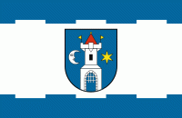
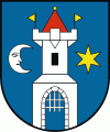
Świebodzice
 |
 |
The town is situated close to Książ Castle, which during World War II, together with the cave complex, was expanded to create private quarters for Adolf Hitler.
The town dates back to the medieval Kingdom of Poland. It was granted town rights by 1279. During World War II, the Germans established a subcamp of the Gross-Rosen concentration camp in the town. In 1957 Pełcznica, and in 1973 Ciernie, were included within the town limits as its new districts.
football club is based in Świebodzice.
Map - Świebodzice
Map


Country - Poland
 |
 |
| Flag of Poland | |
Poland has a temperate transitional climate and its territory traverses the Central European Plain, extending from Baltic Sea in the north to Sudeten and Carpathian Mountains in the south. The longest Polish river is the Vistula, and Poland's highest point is Mount Rysy, situated in the Tatra mountain range of the Carpathians. The country is bordered by Lithuania and Russia to the northeast, Belarus and Ukraine to the east, Slovakia and the Czech Republic to the south, and Germany to the west. It also shares maritime boundaries with Denmark and Sweden.
Currency / Language
| ISO | Currency | Symbol | Significant figures |
|---|---|---|---|
| PLN | Polish złoty | zÅ‚ | 2 |
| ISO | Language |
|---|---|
| PL | Polish language |